Narzędzia użytkownika
Narzędzia witryny
Pasek boczny
en:przestrzenpl:wsteppl:wczytpl
Map opening
A map with the attribute file assigned to the map can be loaded via:
- import of a shapefile, SHP, into the datasheet,
- loading the PQS/PQX file which contains data from shapefiles (SHP).
Import of a Shapefile (SHP)
Import is made by choosing the menu option File→Import data…→SHP/SHX/DBF ESRI Shapefile (*.shp).
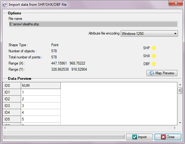
In the import window we can preview the imported map and its attributes saved in a DBF file. If the directory from which we import contains all files necessary for loading the map then the correct reading of appropriate files is confirmed in yellow by proper controls. Attributes ascribed to a shapefile, in the form of a DBF database, are not required for proper loading of a map. An attribute table can be completed after a map file has been loaded, by filling in proper cells of the datasheet linked with the map.
en/przestrzenpl/wsteppl/wczytpl.txt · ostatnio zmienione: 2022/02/16 11:27 przez admin
Narzędzia strony
Wszystkie treści w tym wiki, którym nie przyporządkowano licencji, podlegają licencji: CC Attribution-Noncommercial-Share Alike 4.0 International
