Narzędzia użytkownika
Narzędzia witryny
Pasek boczny
en:przestrzenpl:wsteppl:geometrpl
Geometric calculations
Geometric calculations are formulas (read the User Manual - PQStat (Chapter: Formulas)). The formulas can pertain data which describe map geometry and data visible in a datasheet.
- Formulas for data which describe map geometry -
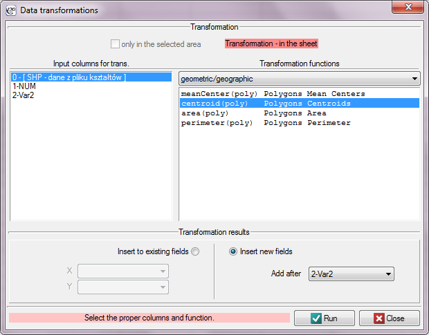
geometric/geographic functions
Data for transformation are chosen from a shapefile (SHP)

Available formulas:
meanCenter (poly) - gives center coordinates for polygons,
centroid (poly) - gives centroid coordinates for polygons,
area (poly) - gives polygon areas,
perimeter (poly) - gives polygon perimeters.
- Formulas for data visible in a datasheet -
creating maps
Available formulas:
map (points) - gives a vector map presenting points together with assigned datasheet.
en/przestrzenpl/wsteppl/geometrpl.txt · ostatnio zmienione: 2022/02/16 12:09 przez admin
Narzędzia strony
Wszystkie treści w tym wiki, którym nie przyporządkowano licencji, podlegają licencji: CC Attribution-Noncommercial-Share Alike 4.0 International

